Blog
Home »
Governments Start Asking Shipping The Uncomfortable Questions On GNSS Spoofing – Splash247.com
Image: Tanker Adalynn on fire after collision with tanker Front Eagle due to GPS spoofing – screen shot from social media What’s new: A report that governments are starting to question the safety of maritime operations during GPS interference and what measures…

India building national “tech heartbeat” – #SWARAJYA
Image: Shutterstock What’s new: India is moving to join the list of nations deploying a clock and fiber-based timing network to provide a sovereign national “tech heartbeat.” Why it’s important: Time and/or timing is essential to virtually…

Univ Alabama Looking for Asst. Professor in PNT
Image: Shutterstock What’s new: The University of Alabama (Tuscaloosa) wants to hire into a “… tenure-track Assistant Professor position in physics related to precision timing, quantum photonics, and positioning, navigation, and timing.” Why…

Israeli counter-drone jammer/spoofer – Defense Blog
Image: HYPNOSIS system – screen grab from IAI video posted on social media What’s new: An Israeli jammer and spoofer combo designed as a non-kinetic anti-drone measure. Why it’s important: As these kinds of systems proliferate GNSS services become…

Telco ignored GPS rollover warning & crashed – Streamline
Image: Shutterstock What’s new: The recent major network outage in Australia was because the provider failed to heed a January warning from Microchip (RNTF member since 2018!) to update software on their equipment for the GPS week rollover. Why it’s important:…
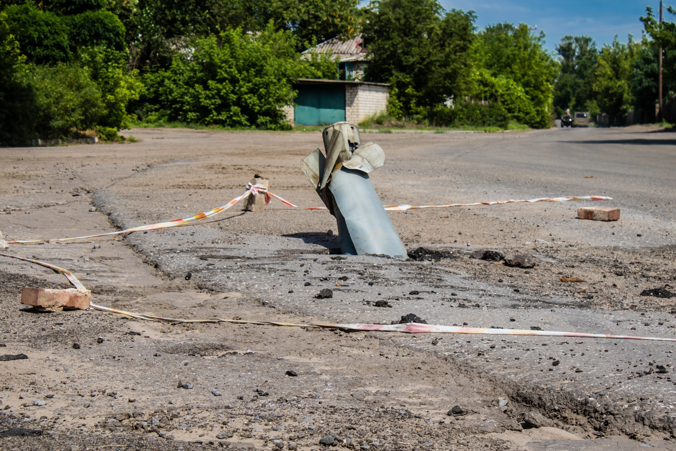
Ukraine’s latest defense against Russian missiles: Making them miss – Politico
Image: Crashed missile in Ukraine, Shutterstock What’s new: An article about Ukraine’s home grown jamming and spoofing EW system. Why it’s important: This reinforces the idea of how PNT and counter PNT have become weapons in and of themselves. The…

Who’s At Fault If You Are Spoofed?
Image: Shutterstock What’s new: A discussion of liability in a maritime context when something bad happens because of jamming or spoofing. Why it’s important: The question of liability and responsibility is critical to getting folks to act. What else to…

Major Teleco Network down because of timing problem – The Conversation
Image: Clock from the Daily Planet (RNT Foundation) What’s new: Information about a major network failure in Australia due to a timing problem. Why it’s important: Networks and timing are essential to any number of mission critical functions and critical…
Help GPS resiliency against Russia with this one simple change – Breaking Defense
Image: Copilot AI What’s new: An opinion piece by the former Commander, USAF Space Command, Gen. William Shelton (ret). Why it’s important: It has recently become public knowledge that Russia can interfere with GPS (and Bei Dou) from space across broad…

Prioritize GPS & PNT or Risk Losing Future Wars
Image: Shutterstock What’s new: An opinion piece about the importance of upgrading GPS and making it as capable a system as possible – a more important and even better piece would have said the same thing, but about PNT. Why it’s important: GPS will…

Maritime Insurance Becoming Concerned About GNSS Disruption – Finally!
Image: Shutterstock What’s new: The war risk insurance company for Norwegian ships is providing incentives for its customers to use Iridium A-PNT as a way of mitigating jamming and spoofing. Why it’s important: Insurance company concerns can often be as or…
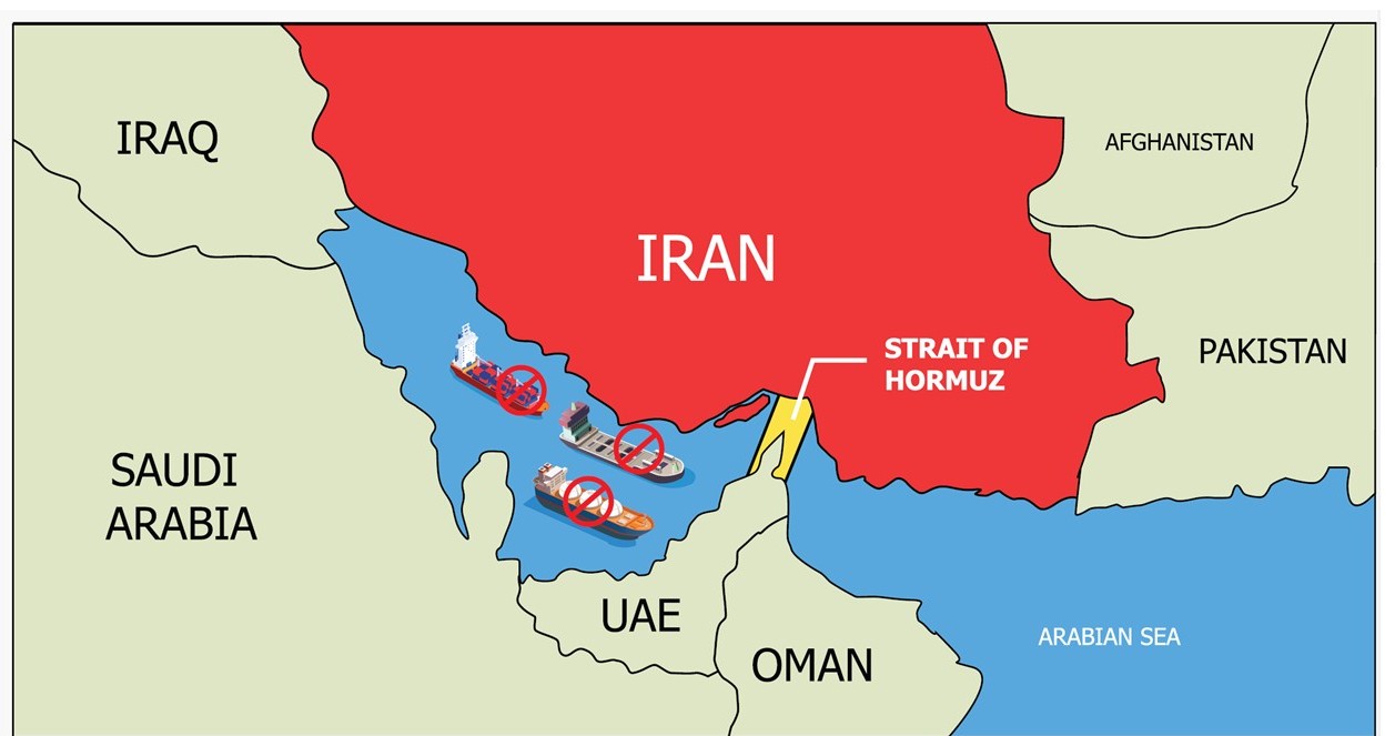
From Hormuz to the cockpit: How warfare and criminal activity undermine GPS and the race to safeguard navigation – The Conversation
Image: Shutterstock What’s new: A great overview article by our colleague Zak Kassas at The Ohio State University. Why it’s important: These kinds of overviews help us to keep issues in perspective and demonstrate the wide breadth and reach of the problem….

The Role of Navigation Systems in Iran’s Military Success – Observer Research Foundation
Image: Copilot AI What’s new: An article from an Indian think tank about China supporting Iran with military-grade Bei Dou. Why it’s important: If the research is to be believed, several of Bei Dou’s advanced and military features have helped Iran…

“DOT must establish a terrestrial backup for GPS” – Photo from 7 years ago today
Image: RNT Foundation image, June 2019 What’s new: A bittersweet anniversary. Seven years ago today members of the RNT Foundation Board of Directors visited with Senators Cruz and Markey to thank them for their sponsorship of the National Timing Resilience and…

Maritime & GNSS Professionals Invited to take Survey!
Image: Shutterstock Maritime & GNSS Professionals Invited to take Survey! Please consider completing a survey for our colleague Gareth’s MSc dissertation. Also please circulate this to others whose work touches GNSS/PNT use or manufacturing. Gareth is conducting a…

The New PNT Reality – Inside GNSS
Image: Shutterstock What’s new: Inside GNSS discusses Locata CEO Nunzio Gambale’s presentation at September’s PNT Leadership Summit and follows up with an interview. Why it’s important: Nunzio’s comments are on-point, as always. We…
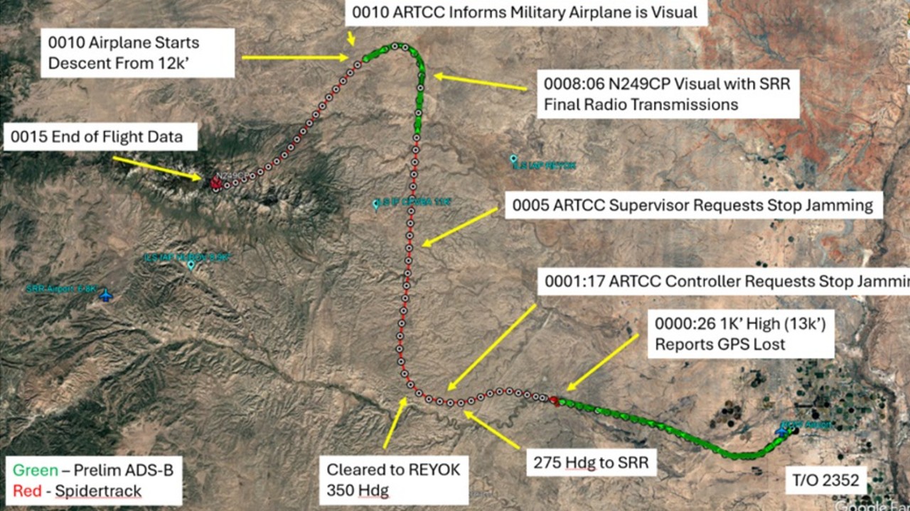
GPS jamming active when King Air struck mountain – AOPA
Image: National Transportation Safety Board (NTSB) What’s new: An NTSB report on a fatal aircraft crash in New Mexico. Two pilots and two flight nurses died. Military GPS jamming was present making the airspace and flight regimes more complex. Why it’s…

The Dangerous Tech Found Aboard ‘Dark-Fleet’ Tankers Captured by the U.S. – Wall Street Journal
Image: USCG – Cyber team member being lowered to a dark fleet tanker. What’s new: A WSJ exclusive about the complex cyber and EW capabilities found aboard dark fleet vessels. Why its important: It outlines a high degree of sophistication in many areas,…
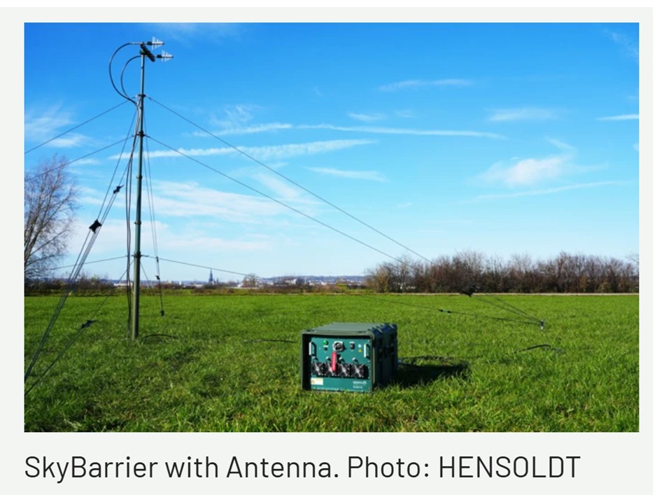
HENSOLDT presents SkyBarrier: a mobile broadband jammer for satellite-based navigation signals
Image: HENSOLDT What’s new: A multi-GNSS jammer from German manufacturer HENSOLDT. Why it’s important: This kind of very open advertising is a symptom of how drones have become a real threat and GNSS jamming is moving into the mainstream. What else to…

How to Hack a Superyacht – The Walrus
Image: Shutterstock What’s new: An article about how in 2009 Todd Humphreys, inspired by Logan Scott, became a spoofer. Why it’s important: It is a fascinating story the whole PNT community will enjoy. It includes how Todd came to find himself in the…

We Trust GPS With Our Lives. It’s About To Collapse – The Telegraph
Image: Bloomsbury Publishing What’s new: A review of the new book about the history and current state of GPS and GNSS by Katherine Dunn. Why it’s important: The book is engaging and informative for everyone and should be of particular interest to those in…
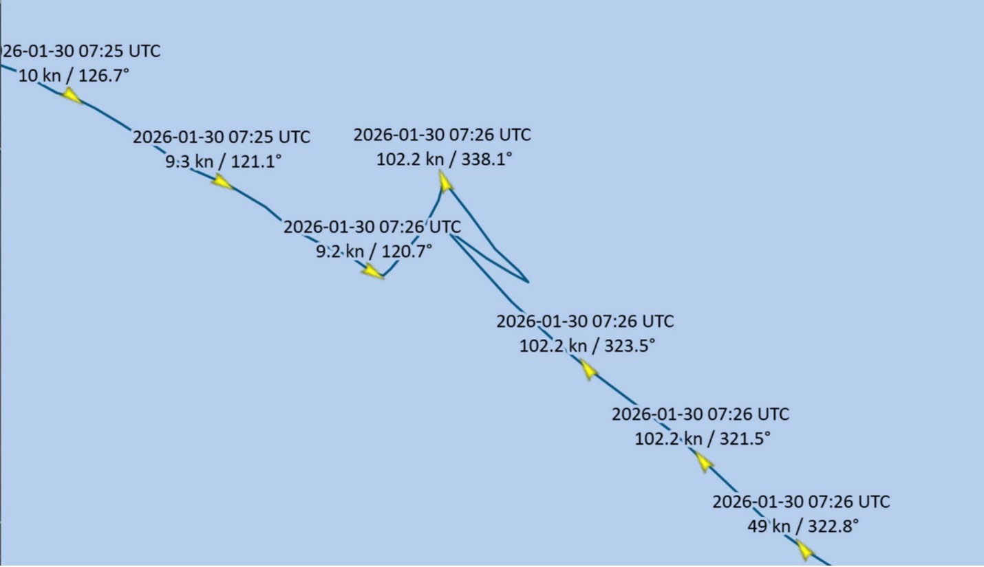
LA/Long Beach VTIS Records Spoofing Event in January 2026 GPS Test Window – Inside GNSS
Image: CAPT James Haley What’s new: A rare spoofing event in the continental USA. Why it’s important: It shows no one is safe anywhere. Also that not all spoofing is malicious (but it is always dangerous). What else to know: CAPT Haley did most of the work…
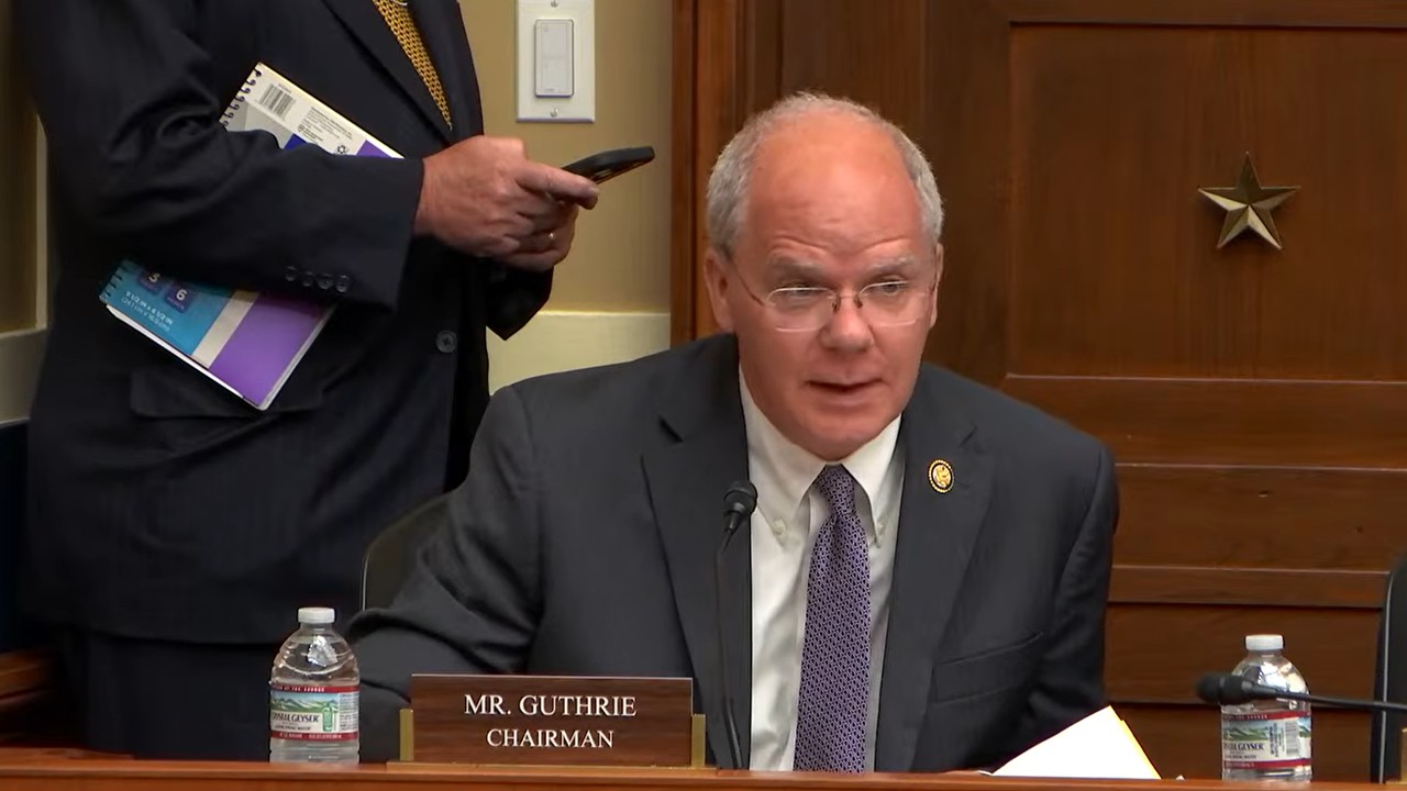
Congress Weighs the State of U.S. PNT: GPS Modernization, Interference Enforcement and the Search for Complementary Architecture – Inside GNSS
Image: Chairman Guthrie, House Energy and Commerce Committee What’s new: A Congressional hearing about PNT policy and backups. Why it’s important: This hearing showed: Congressional concern about the issue – always very important. Significant…

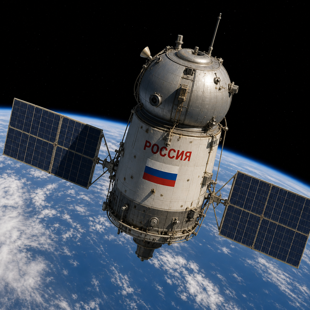
Russia is jamming GPS from space – SpaceNews
Image: Copilot AI What’s new: Another report about Todd Humphreys’ efforts, though this one has a bit more of the backstory about how this was discovered. Why it’s important: We hope this helps raise awareness about threats and risks. What else to…

Inside GNSS, Inside LEO: LEO PNT – Why Now?
Image: Shutterstock What’s new: A new recurring feature at Inside GNSS . Why it’s important: LEO PNT has enormous potential to provide similar services as MEO PNT but with greater performance and greater resilience. What else to know: Xona, Trustpoint,…
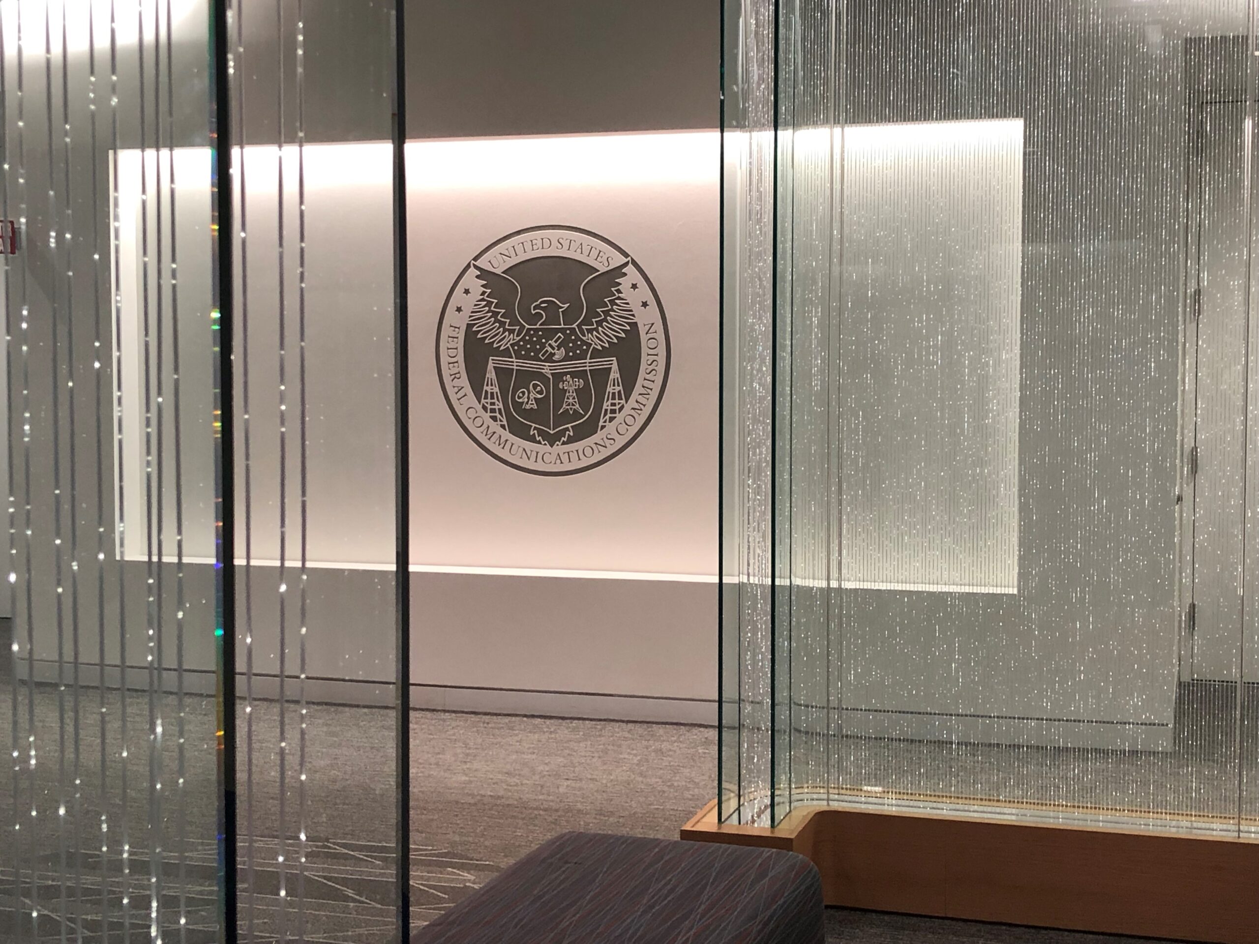
Why the FCC Must Reject Ligado’s Latest Plan – Broadband Breakfast
Image: RNT Foundation What’s new: It has been six years since the FCC ruled in favor of Ligado. Now Ligado wants to change almost everything about the bargain it struck with the commission. Why it’s important: Use of some of the frequencies Ligado was…

Russian Satellites Have Been Jamming GPS Signals Across Europe, Scientists Say – New York Times
Image: Shutterstock What’s new: Prof Todd Humphreys and his team at the University of Texas Radionavigation Lab, in cooperation with a Stanford researcher, have identified Russian satellites that have been testing jamming capability against GPS and Bei Dou. …

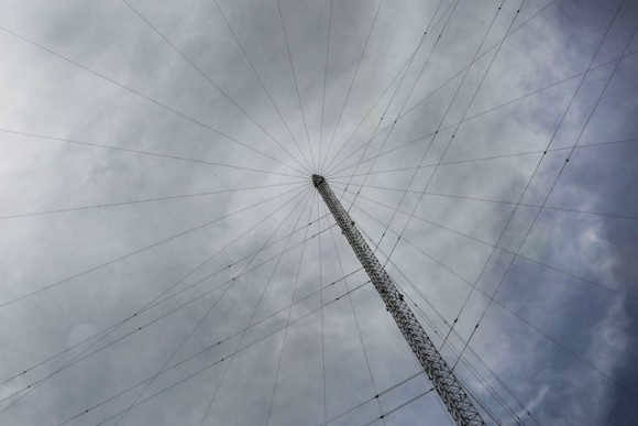
New Company for Broadcast Positioning System – NAB
Image: Shutterstock What’s new: The National Association of Broadcasters (NAB) has formed a separate company to develop, advocate for, and deploy the Broadcast Positioning System (BPS). Why it’s important: NAB has put increasing effort behind BPS since its…

Standalone Magnetometry Is the New GPS – IEEE Spectrum
Image: Shutterstock What’s new: An article about forms of navigation using aspects of the earth’s magnetic field. Why it’s important: Autonomous navigation is becoming more interesting for a number of applications in a world where interference with…

Munich 9 Years On: Same Message, More Urgency – Inside GNSS
Image: Shutterstock What’s new: RNTF President Dana Goward’s column for the May/June edition of Inside GNSS+. Why it’s important: It discusses a PNT example of how concern within the tech community does not necessarily turn into action by political…
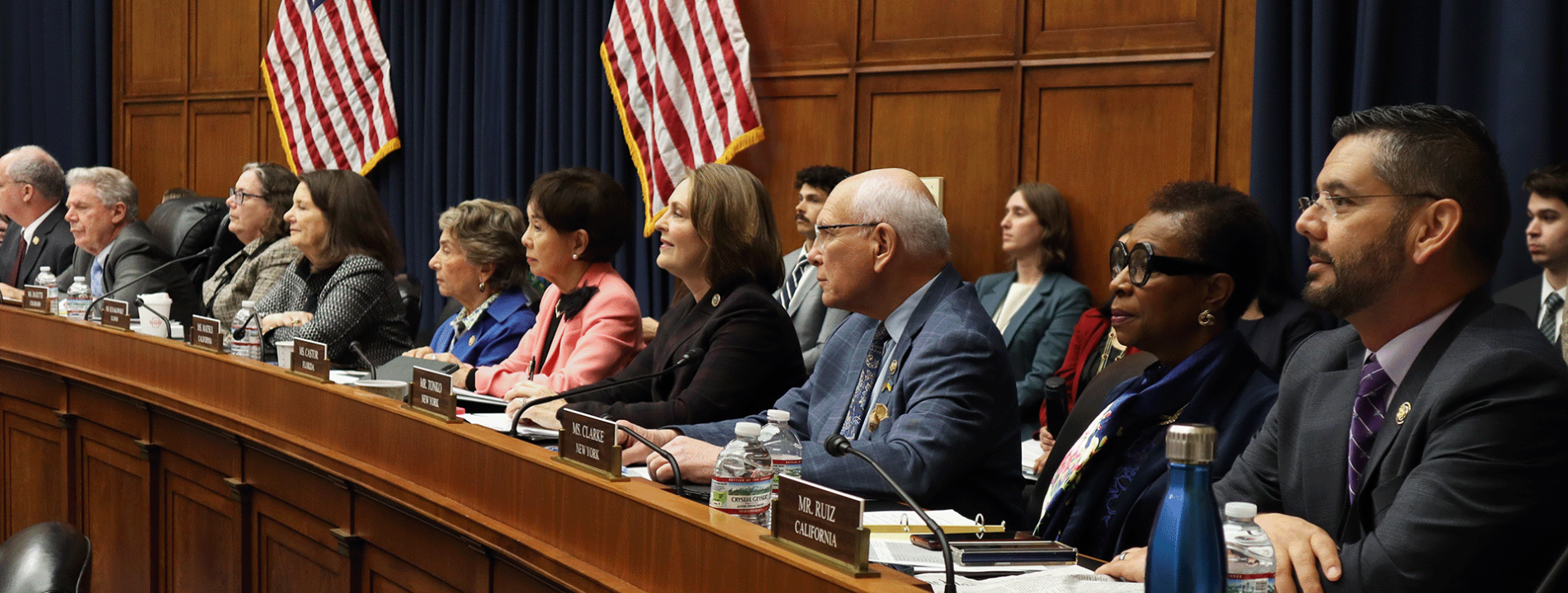
US Congress hearing on PNT – June 4th
Image credit: House Energy and Commerce Committee What’s new: A congressional hearing titled Where Are We?: Examining Positioning, Navigation, and Timing Capabilities in the United States. Why it’s important: The hearing is being held by the…

House Armed Services Committee Calls for Single PNT Overseer in FY27 NDAA Markup – Inside GNSS
Image: RNT Foundation What’s new: Proposed legislation calling for the Department of Defense (DOD) to consolidate leadership of PNT issues. Why it’s important: In the opinion of many, including the now defunct National Space-based PNT Advisory Board,…
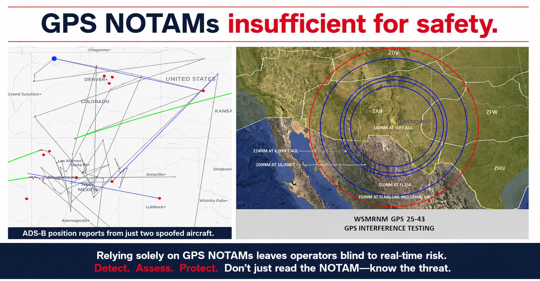
GPS NOTAMS Not Enough for Safety – Jeremy Bennington at Spirent
Image: Jeremy Bennington What’s new: An important opinion piece on LinkedIn by RNTF member Jeremy Bennington at Spirent about intentional GPS disruption and aviation safety. Why it’s important: People’s lives are at stake. False contacts, bad…
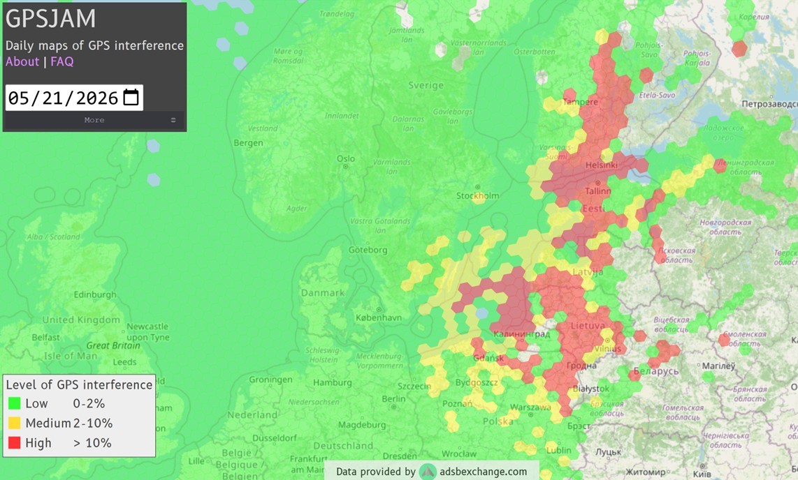
UK Defence Minister’s Aircraft Jammed… Again – BBC
Image: GPSJam.org – Jamming in the Baltic the day of the minister’s flight What’s new: The aircraft carrying another high ranking official experienced jamming in northern Europe. Why it’s important: Even though jamming impacts tens of thousands…
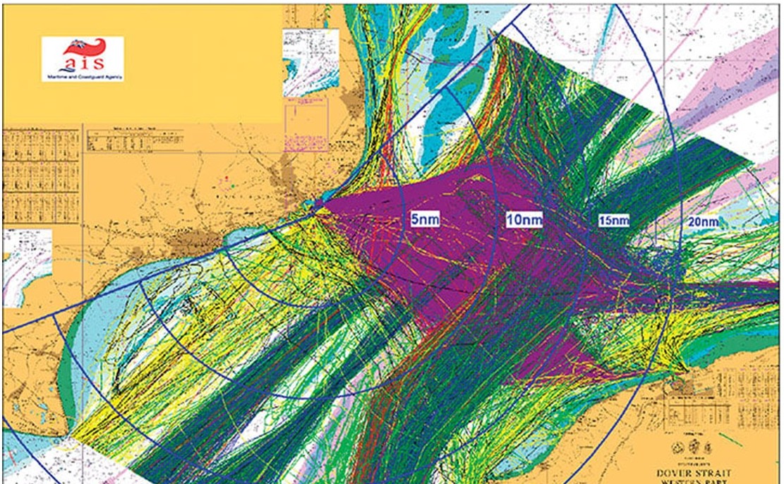
UK maritime navigation leader on chokepoints – PoliticsHome
Image: UK General Lighthouse Authority – 28 days of ship traffic in Dover Strait What’s new: An opinion piece from the head of the UK’s General Lighthouse Authority which is responsible for maritime aids to navigation and assists government in marine…
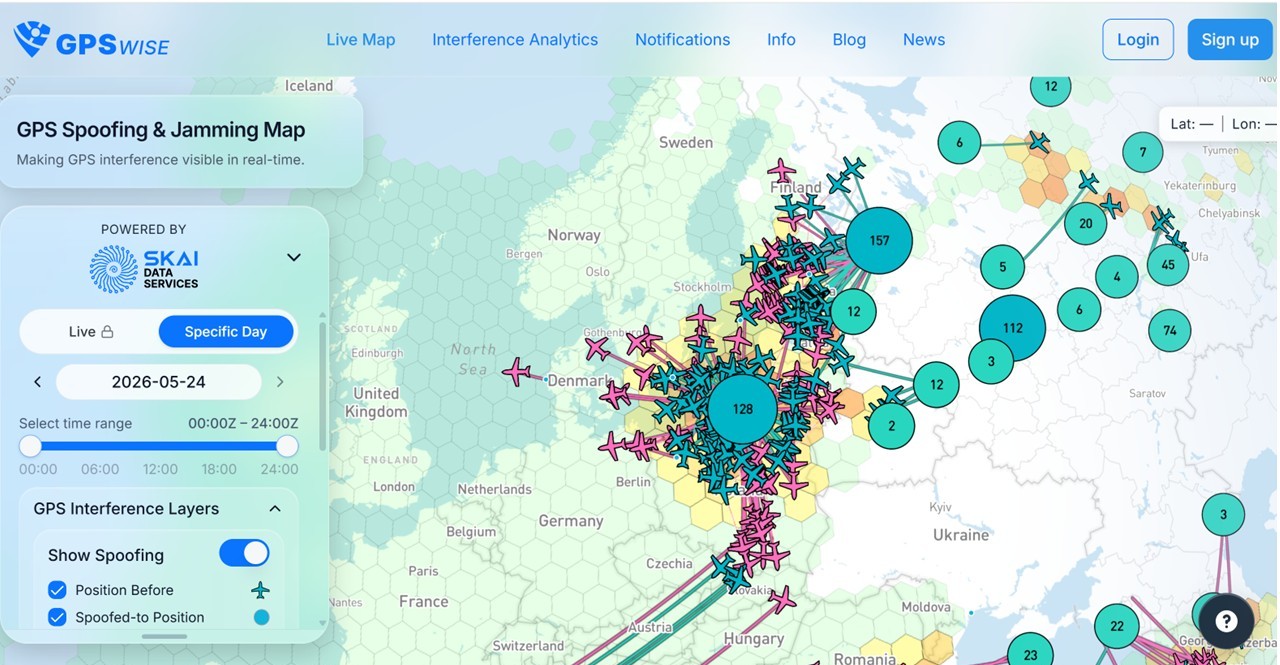
Lithuania Warns Russia Can Spoof GPS Across Europe – tovima.com
Image: Spoofing activity in northern Europe displayed on GPSWise.areo What’s new: A report of increased Russian spoofing capability in Kaliningrad. Why it’s important: Spoofing is hazardously misleading information and can result in tragedy. What else to…

ASATs, debris, EW… Global Counter-space Report – Secure World Foundation
Image: Shutterstock What’s new: The annual “ Global Counterspace Capabilities Report ” from our friends at the Secure World Foundation (SWF) Why it’s important: More and more things depend upon space. This means that adversaries have more and…

Russia attacks NATO with drones – The Telegraph
Image: Shutterstock What’s new: A report of Russia spoofing Ukrainian drones and sending them against NATO targets. Why it’s important: Russia is attacking NATO kinetically. This is not just electronic warfare anymore. Secondarily: If true, it shows…
Canada Ending Radio Time Signals (accuracy <1ms)
Image: Shutterstock What’s new: Canada has announced it is cancelling its short wave time signals as of the 22nd of June 2026. Why it’s important: The other sources of official time from the Canadian government (National Research Council, or NRC) are less…
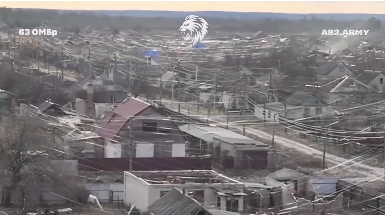
US wants Ukraine’s AI-assisted targeting, GPS-free navigation, and IP to reproduce it, but Zelenskyy has red line – Euromaidan
Image: AB3.Army on Youtube – The town of Lyman in Ukraine draped with fiber optic cable from both Ukrainian and Russian FPV drones. What’s new: An interesting article about drone warfare, and how the U.S. is asking something from Ukraine, a bit of a…

“We can track Starlink users…” – Fast Company
Image: Shutterstock What’s new: A report that multiple companies are offering governments the ability to geolocate Starlink terminals. Why it’s important: Security concerns – an adversary could target, kidnap, kill, etc. users. Privacy concerns…

Honeybees teach drones how to navigate without GPS – Cybernews
Image: Shutterstock What’s new: An interesting form of autonomous navigation based on nature. Why it’s important: Autonomous systems have an important place in an overall PNT architecture. For some applications they are the best/only method. This system…

PNT cyber guidance update – NIST wants your input
Image: RNT Foundation What’s new: Draft updated PNT cyber guidance from NIST. They are seeking public comment and input. Why it’s important: PNT and cyber are well intertwined. PNT is an essential tech infrastructure so protecting it from malicious cyber…
GPS Is Not Guaranteed: Impact on ports (Webinar 21 May)
Image: Shutterstock What’s new: A webinar featuring our colleague Matt Shirley. Matt is a professional port pilot and has some interesting insights on maritime reliance on GPS/GNSS, how things could go wrong without resilient PNT, and how things could go better…

Intl Airline Pilots Assn calls for changes & GPS backup
Image: Aircraft near Delhi, India being spoofed 5 Nov 2025 – GPSWise What’s new: The International Federation of Air Line Pilots’ Associations (IFALPA) called for actions to combat GNSS disruption from ICAO, nations, air navigation service providers,…

What is system “resilience”?
Image: Shutterstock What’s new: Discussion of system “resilience,” especially in the context of PNT. Why it’s important: We sometimes hear folks ask for a definition of “resilience.” Many are genuinely seeking to define terms to…

RNT Foundation Annual Meeting a Huge Success
Image: RNT Foundation What’s new: Our recent annual meeting was a huge success featuring: Comments from Department of Defense/War Assistant Secretary for Space Policy, Hon. Marc Berkowitz, Comments from Department of Transportation Acting Assistant Secretary for…

UK Armed Forces better protected with new jamming-proof navigation tech – Gov.UK
Image: Shutterstock What’s new: The UK government’s formal announcement about their MOD’s contract for a tactical/ deployable eLoran capability. Why it’s important: This is the first instance we know about of a western military/ government…

When GPS Fails: Why Maritime Needs Resilient Navigation – Hellenic Shipping News
Image: Ship fire after collision during GPS disruption – Singapore Maritime Security Agency What’s new: A discussion of the importance of GPS/GNSS to maritime – especially in ports. This is the first discussion of its type we have seen. Why…

Starlink Ending User Access to Location Data – Inside GNSS
Image: Hidden TTY on Reddit What’s new: Starlink announced it will no longer allow users to access location information on their terminals. Why it’s important: Some users were able to use that information to navigate in GNSS denied environments. What else…
Blog
Governments Start Asking Shipping The Uncomfortable Questions On GNSS Spoofing – Splash247.com
Image: Tanker Adalynn on fire after collision with tanker Front Eagle due to GPS spoofing – screen shot from social media What’s new: A report that governments are starting to question the safety of maritime operations during GPS interference and what…
India building national “tech heartbeat” – #SWARAJYA
Image: Shutterstock What’s new: India is moving to join the list of nations deploying a clock and fiber-based timing network to provide a sovereign national “tech heartbeat.” Why it’s important: Time and/or timing is essential to virtually…
Univ Alabama Looking for Asst. Professor in PNT
Image: Shutterstock What’s new: The University of Alabama (Tuscaloosa) wants to hire into a “… tenure-track Assistant Professor position in physics related to precision timing, quantum photonics, and positioning, navigation, and timing.” Why…
Israeli counter-drone jammer/spoofer – Defense Blog
Image: HYPNOSIS system – screen grab from IAI video posted on social media What’s new: An Israeli jammer and spoofer combo designed as a non-kinetic anti-drone measure. Why it’s important: As these kinds of systems proliferate GNSS services become…