Image: National Transportation Safety Board (NTSB)
What’s new: An NTSB report on a fatal aircraft crash in New Mexico. Two pilots and two flight nurses died. Military GPS jamming was present making the airspace and flight regimes more complex.
Why it’s important:
- GPS is a very important tool in aviation and other operations. When it is compromised, really bad things can happen.
- One of the government and industry’s safeguards against GPS interference is pilot awareness and training. Yet this report shows that the pilots reported a GPS failure, so they were certainly aware. And a professional emergency medical transport pilots, they were far better trained and prepared than many who fly that type of aircraft.
What else to know:
- Note that the NTSB has not said GPS jamming was the cause. It was present. As such it had to be a factor, if only by making the nighttime and instrument approach flight regime and airspace a bit more complex.
- Often times near-accidents can provide warnings of impending mishaps and allow authorities to intervene.
- One high profile near-miss we know of was in 2019 in which GPS interference (source never found) nearly caused a commercial passenger aircraft to impact a mountain near Sun Valley, ID.
- There has been a lot of reporting of GPS interference and how it degrades aviation safety. Government and industry folks like to say “it reduces the safety margin.” Is that still a good way to talk about this or does it gloss over what should be a significant concern?
- GPS is defined by the Department of Transportation as as “Safety of Life” system. Are they acting that way? Is the government doing everything it can to protect GPS satellites, signals, and users?
![]()
GPS jamming active when King Air struck mountain
NTSB reports on New Mexico air ambulance crash that killed four, sparked wildfire
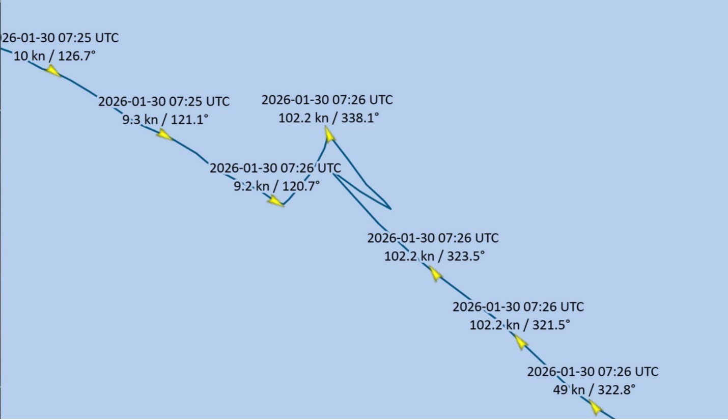
A Beechcraft King Air collided with a New Mexico mountain ridge while attempting an instrument approach shortly after midnight on a moonless May 14, killing four people and igniting a wildfire that took nearly a month to extinguish. GPS interference—an increasingly common event in recent years—figures prominently in the preliminary report released by the NTSB.
Investigators plotted GPS data of the fatal air ambulance flight from two sources: recorded ADS-B data, and a Spidertracks device onboard the aircraft. Two flight nurses and two pilots planned a short flight from their home base in Roswell Air Center Airport to Sierra Blanca Regional Airport in Ruidoso. Visibility was 10 miles with clear skies when the flight departed Roswell to pick up a patient for transport to Albuquerque.
It is not clear whether the flight crew was aware of the GPS jamming underway in the region before the King Air lifted off at 11:52 p.m. local time on May 13. The pilots, operating under FAR Part 135, contacted air traffic control at 11:54 p.m. during the initial climb, and the flight was cleared “as filed” to their destination, minutes away, and directed to maintain 12,000 feet.
Investigators compared the GPS data recorded by ADS-B and Spidertracks and found discrepancies in recorded altitudes that coincided with the military GPS jamming that was underway at the time.