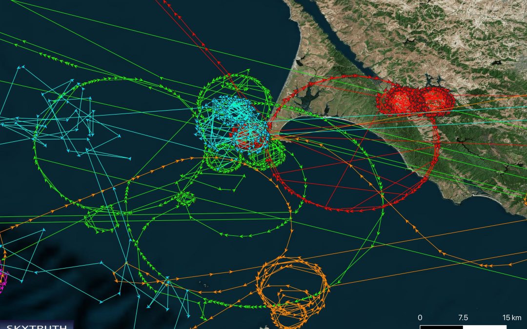
Ship locations from around the world have been spoofed to show them circling off of Pt. Reyes, California. Image courtesy of Skytruth
Blog Editor’s Note: We are seeing more of these kinds of articles in major outlet as the world “discovers” the problem again and again.
NYT also carried an opinion piece on GPS vulnerability last year.
As with most NYT articles, very well written and thorough.
We are glad to see the positive coverage of Windward with whom we have worked in the past. Also to have been able to contribute to this piece.

A technology enabling the transmission of fake locations to carry out murky or even illegal business operations could have profound implications for the enforcement of international law.
The scrappy oil tanker waited to load fuel at a dilapidated jetty projecting from a giant Venezuelan refinery on a December morning. A string of abandoned ships listed in the surrounding turquoise Caribbean waters, a testament to the country’s decay after years of economic hardships and U.S. sanctions.
Yet, on computer screens, the ship — called Reliable — appeared nearly 300 nautical miles away, drifting innocuously off the coast of St. Lucia in the Caribbean. According to Reliable’s satellite location transmissions, the ship had not been to Venezuela in at least a decade.
Shipping data researchers have identified hundreds of cases like Reliable, where a ship has transmitted fake location coordinates in order to carry out murky and even illegal business operations and circumvent international laws and sanctions.
The digital mirage — enabled by a spreading technology — could transform how goods are moved around the world, with profound implications for the enforcement of international law, organized crime and global trade.


