
Editor’s Note: The item below on June’s GPS spoofing is outstanding. It was published by the government-owned Norwegian Public Broadcaster, NRK. The article includes video of:
- Spoofing of the June incident in the Black Sea (video created by the Norwegian Defense Research Institute (FFI) from archived data).
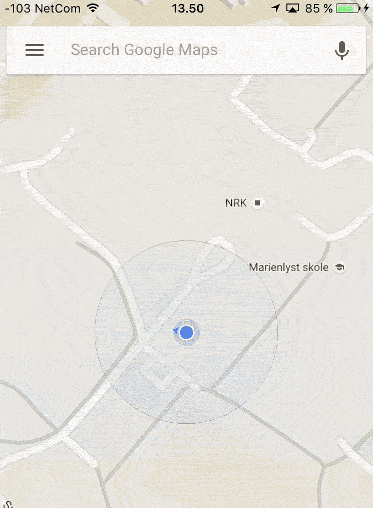
- FFI spoofing a GPS receiver in Norway into thinking it was in Japan.
- A GPS receiver near the Kremlin in Moscow being spoofed into thinking it was 40km away at the airport.
Our congratulations to reporters Henrik Lied and Morten Jentoft for a job exceptionally well done.
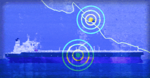
Image – NRKbeta
NRKbeta
GPS freaking out? Maybe you’re too close to Putin
Over several days in June, more than 20 ships were subjected to a GPS attack in the Black Sea. Experts fear that military forces have developed technology that fools GPS receivers to receive incorrect positions. NRKbeta has tested the technology.
August, 2015
At the office of the Norwegian Defense Research Institute (FFI), a handful of people sit on a computer screen. A red dot lights up on a digital world map and places us at Kjeller, outside Lillestrøm.
We enter some commands on our laptop, and soon afterwards, the red dot moves to a university outside Kasugai in Japan. The dot moves in perfect circles around one of the buildings. The Google Maps app on an iPhone shows the same wrong location.
Two minutes later, the dot is back at Kjeller.
The purpose of the visit was to test a system that claims to be able to send counterfeit satellite signals to the vast majority of modern GPS receivers. Two years later we have taken up the thread. Now it seems that this technology can be used on a large scale by military forces.
Large parts of modern infrastructure are based on GPS – the global positioning system that is capable of giving you very exact geographic positions. GPS is a best friend on a road trip to a strange city, who always knows which way to turn around to find out.
That’s the way most people connect with GPS. But in reality, the system is used for far more critical social tasks than helping you find the hotel on vacation.
A variety of industries are in one way or another dependent on GPS. Not necessarily the positioning, but the clock: The GPS system is composed of 24 satellites that contain each of its atomic watches. The time reported from the GPS system is thus one of the most accurate ones, and acts as a kind of headphone for a lot of modern infrastructure.
For example, a stock exchange, where the brokerage houses largely make use of automated trading systems. When these systems perform thousands of trades per second, each millisecond can provide variations of millions of dollars. Then it is important that the clock that registers the trades is accurate.
The same applies to telecom operators, who have customers who require that the call is not interrupted when the mobile phone jumps from one mobile tower to another. These systems also use the GPS clock for time synchronization.
But few are more dependent on GPS than shipping: Hundreds of ships move in ocean areas without good radar coverage and get visual landmarks. Here, GPS is a vital technology to find the right port, and this allows huge cargo ships to navigate the autopilot over long distances.

