Image: Shutterstock
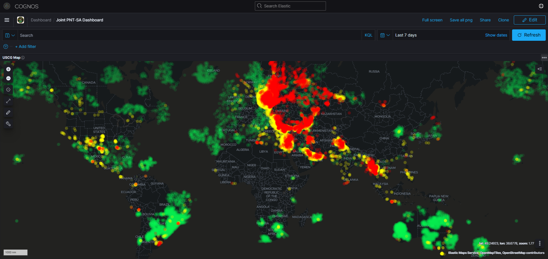
What’s new: A post about how detection of GPS / GNSS jamming & spoofing should be combined with other data to create good, hopefully actionable, intelligence.
Why it’s important: Intentional interference with GNSS is often done to conceal malicious activity. Knowing as much as possible about that activity enables better law enforcement, anti-terrorism, environmental protection, and other actions needed for the common good.
What else to know:
- Intelligence is all well and good as long as it is actionable and acted upon.
- In the early days of the Automatic Identification System (AIS) which is the maritime self-reporting/tracking system based on GPS, the intelligence and enforcement community wasn’t worried about false location reporting (there are other ways of doing it besides spoofing) because it would create a detectable anomaly. The bad actors would essentially be identifying themselves. The problem became that there were too many anomalies and not enough government resources to act on them.
- Drug trafficking is a good example. There is so much going on and the incentives are so great that governments do not have the aircraft and vessels (or do not want to devote the aircraft and vessels), needed to make a big impact on the flow.
![]()
Identifying Emerging Security Threats Through Satellite Data Fusion
Introduction
Satellite data, including Automatic Identification System (AIS) feeds, Synthetic Aperture Radar (SAR) imagery, GNSS signals and other sensor readings, provides a powerful window into activity at sea and on land. However, satellite data alone rarely provides enough context to support critical decisions. For national security agencies and maritime organizations, the challenge is to fuse this information with other intelligence sources – from human intelligence (HUMINT) and open-source intelligence (OSINT) to transaction records and corporate registries – so analysts can quickly identify threats, anticipate patterns and act decisively.