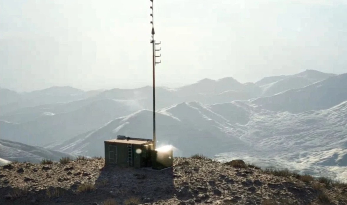
Image: GPSPATRON
What’s new: A study of the impacts of GNSS interference in the Baltic at sea level (maritime and ground level impacts) by GPSPATRON and Gdynia Maritime University. While we have had anecdotal reports of interference impacting maritime and infrastructure in the region, this is the first systematic look that we know of.
Why it’s important: Key findings included:
- Persistent GNSS Interference: A total of 84 hours of GNSS interference was detected, indicating continuous disruptions in the region. Most incidents were caused by jamming rather than spoofing.
- October saw peak interference levels: The month recorded six major jamming events totaling 29 hours, showing an escalation in disruption frequency and severity.
- Maritime sources of interference suspected: Signal pattern analysis confirms that the source was mobile, reinforcing the likelihood of a single ship or multiple vessels operating the same advanced jamming technology.
- High-Precision Jamming Signatures: The interference signals detected exhibit structured modulation patterns and frequency agility, suggesting the use of highly sophisticated jamming techniques. These characteristics indicate high-grade equipment, potentially of military origin, with capabilities far exceeding those of common commercial jammers. The consistency and precision of these disruptions highlight the need for further investigation into the source and intent behind these operations.
- No link to ADS-B reports: Despite extensive ground-level interference, ADS-B-based monitoring systems failed to register corresponding events, highlighting their limitations in assessing terrestrial threats.
- Long-duration disruptions: Some interference events lasted more than seven hours, significantly affecting GNSS-dependent operations in maritime navigation and port activities.
What else to know: GPSPATRON publishes technical papers such as these regularly on their website which should be of interest to many or our readers.

GNSS Disruption at Sea Level: An interference study in the Baltic Sea
For years, aviation safety organizations and maritime authorities have relied on ADS-B-based reports to assess GNSS interference. Services such as gpsjam.org, spoofing.skai-data-services.com and flightradar24 have provided valuable insights into interference patterns at high altitudes. However, this data tells only part of the story. Ground-based infrastructure — ports, telecommunications networks, and precision navigation systems — operate in a vastly different signal environment. High-altitude detections cannot reliably indicate the presence or impact of interference at sea level.
To address this critical knowledge gap, GPSPATRON and Gdynia Maritime University have conducted a six-month study on GNSS interference in the Baltic Sea. Using terrestrial GNSS monitoring technology, the project examined the frequency, duration and characteristics of interference events affecting maritime navigation and other critical applications.