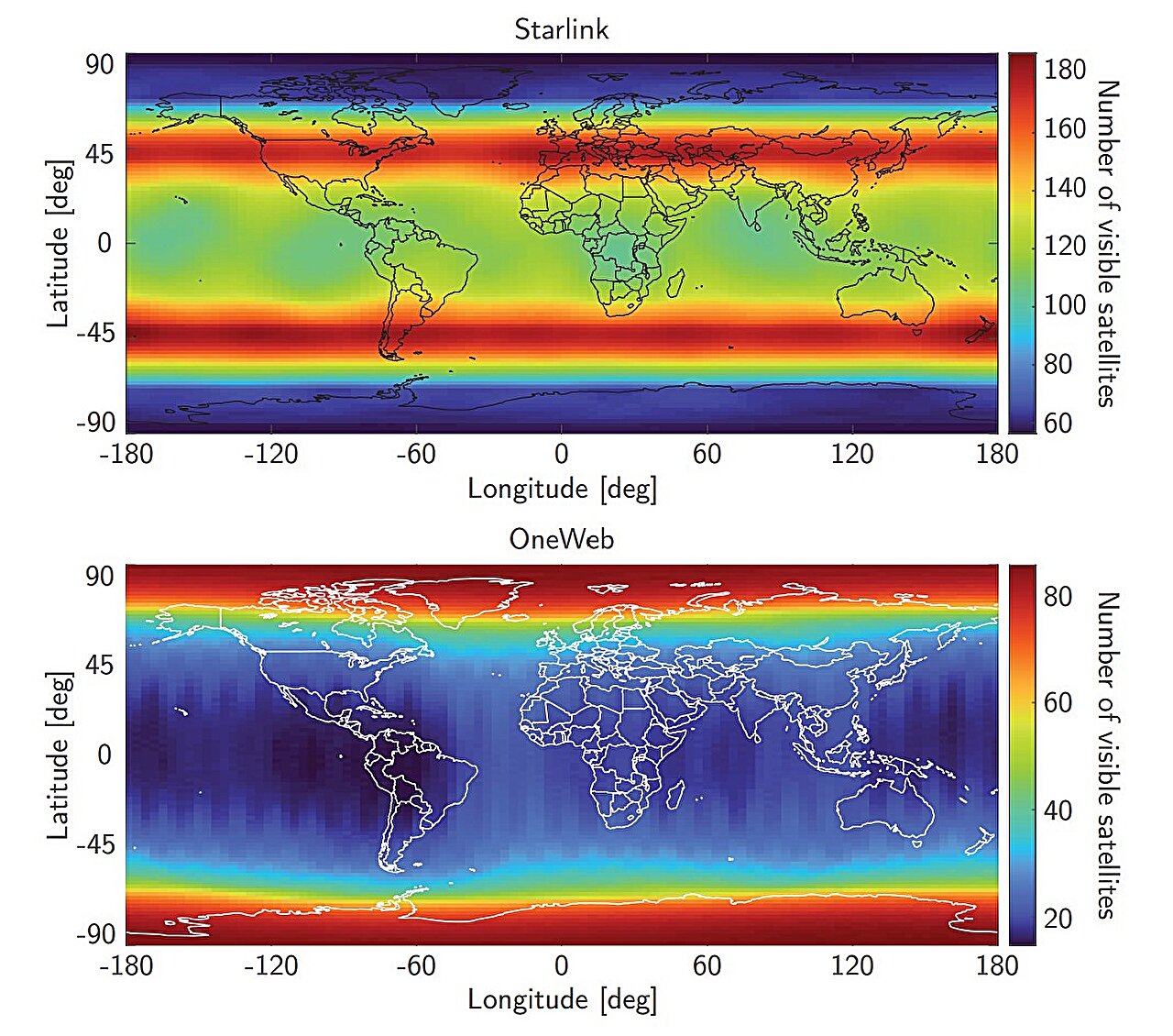
Image: Navigating the Arctic Circle with Starlink and OneWeb LEO Satellites (2025).
What’s new: A paper from Ohio State University and Prof Zak Kassas.
Why it’s important: GPS is great but, like any system it has its limitations. identifying and using complementary systems can improve PNT resilience.
What else to know: The paper recently won an IEEE award and the article includes a link to a video discussing navigating in the Arctic.
![]()
Starlink, OneWeb satellites provide accurate positioning in GPS-weak zones
As disruptions to GPS services increase globally, radio signals from low-Earth orbit (LEO) satellites could become reliable navigation alternatives, a new study suggests.
From transportation and telecommunications to finance and public infrastructure, nearly all sectors depend on Global Navigation Satellite Systems (GNSS) such as GPS for critical positioning, navigation and timing information. Yet as these signals are highly susceptible to interference like intentional jamming and spoofing, new technologies are needed to counter this dependence.
How LEO satellites improve navigation
Now, by exploiting signals from the Starlink and OneWeb constellations—satellites primarily used to deliver secure internet connectivity—researchers found they could be used to improve ship navigation accuracy in the Arctic, an area where GPS coverage and signals are typically degraded.