Cover Image: Shutterstock, Diagram below: Prof. Todd Humphreys, UT Austin
What’s New: We responded to a U.S. Dept. of Transportation request for information about Advanced Air Mobility (AAM) with eight recommendations for achieving safe and efficient navigation.
Definition from the FAA: Advanced Air Mobility (AAM) is a rapidly-emerging, new sector of the aerospace industry which aims to safely and efficiently integrate highly automated aircraft into the National Airspace System.
Why It’s Important: America’s current navigation infrastructure cannot support AAM. For AAM to be a success people will have to have the utmost confidence in both the ability of the aircraft to fly safely and the system to get the aircraft where it is supposed to go.
What to Know:
- A system of automated aircraft is probably easier to institute than self-driving cars and trucks, and will likely happen first. – AAM will have a lot fewer vehicles and a lot more space to operate in.
- Sufficient technologies exist now to create a safe and efficient AAM navigation system.
- The U.S. government has been reluctant to implement any non-GPS navigation technologies.
- The FAA has even had trouble keeping aviation terrestrial beacons (called VORs and DMEs) current.
- By contrast, China has multiple space-based and terrestrial sources of navigation information.
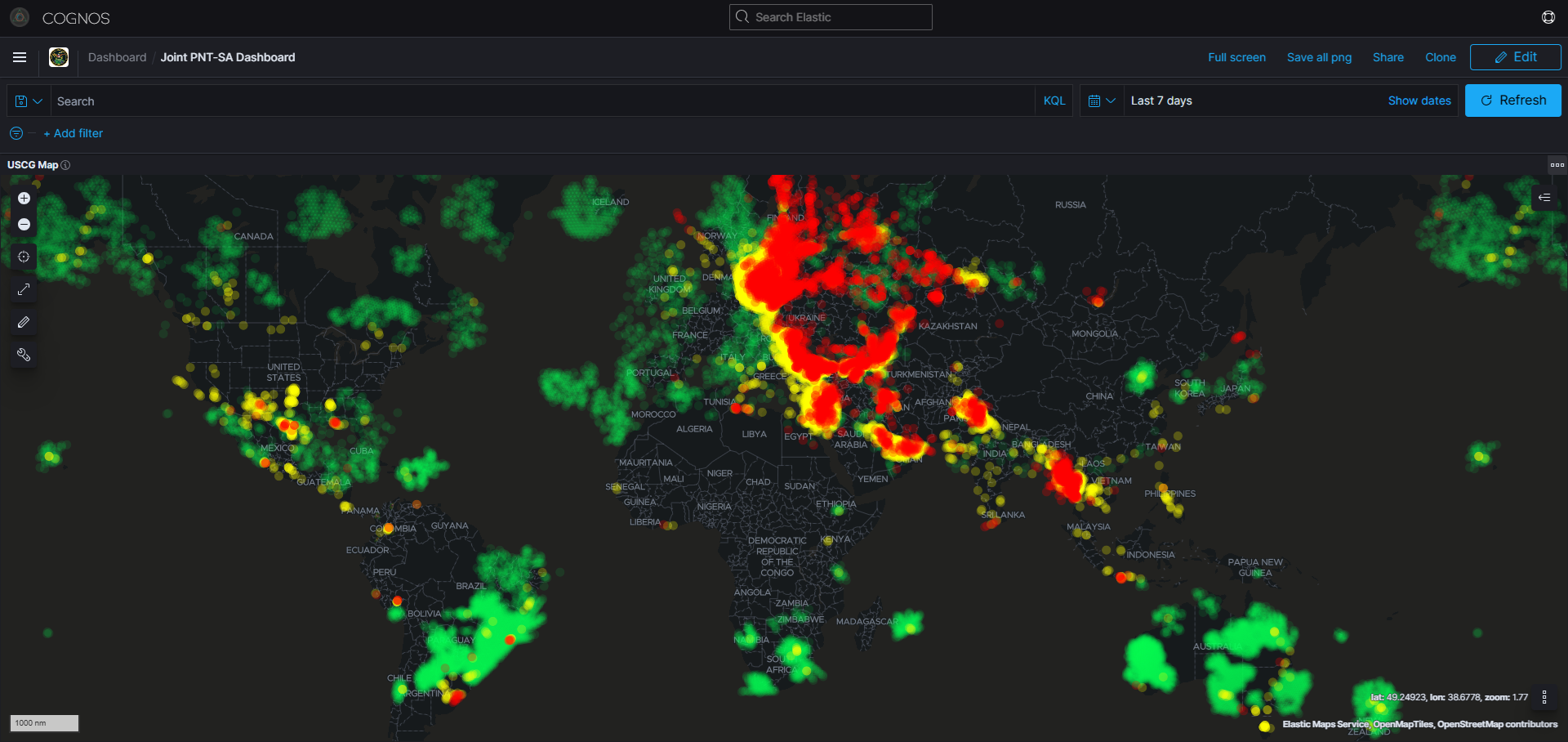
![]()
RFI Response: Advanced Air Mobility
Docket No. DOT–OST–2023–0079
Response provided by the Resilient Navigation and Timing Foundation, a public benefit scientific and educational charity, 501(c)3. We advocate for policies and systems to protect GPS/GNSS satellites, signals, and users.
One of the biggest challenges implementing advanced mobility in the United States is a lack of infrastructure to adequately support safe navigation.
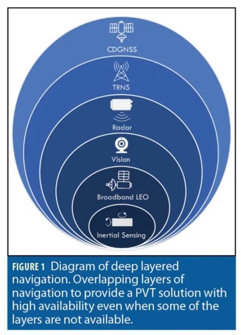 Creating and maintaining confidence in system safety and reliability will require multiple and diverse sources of positioning, navigation, and timing (PNT). One model of this has been proposed by Professor Todd Humphreys at the University of Texas, Austin.[1]
While this model may not ultimately be the one selected by the government, it does provide a structure for examining the required navigation capabilities and systems.
On-board systems such as inertial sensors, vision, and radar, will, of course, be the responsibility of the vehicle manufacturer, though the government will have a role in establishing performance standards and certification.
The government must also ensure that sufficient external systems are established to enable vehicles to navigate safely and securely.
We recommend several principles apply as the government considers establishing what will become a National Resilient Positioning, Navigation, and Timing Architecture.[2]
- The architecture must provide “deep layered” navigation as proposed by Dr. Humphreys. This will require multiple and diverse sources such that a threat vector disrupting one source is unlikely to impact others. We are making no system recommendations here as the Department of Transportation’s Office of the Assistant Secretary for Research and Technology (OST-R) has sufficient expertise and experience with available and future technologies.[3]
- The architecture must support operation over the entire landmass of the United States and its maritime Exclusive Economic Zone (roughly up to 200 nautical miles offshore). While the government may not want to ensure the same level of external source accuracy in every type of environment, availability, integrity, and continuity must be consistent to support safety of life everywhere.
- Most systems do not need to be government-developed and owned. A robust architecture can and should be established through long-term service contracts with commercial entities whenever possible.
- Many technologies are mature and can be quickly made available as services.
- Service contracts for mature technologies are almost always a quicker way to bring capabilities online, and almost always offer lower total life-cycle costs.
- The government must commit to maintaining each system as part of the national architecture for at least 25 years. Equipment developers and manufacturers will be much less likely to incorporate new signals otherwise.
- Make barriers to use as low as possible. Safe and efficient airspace for advanced air mobility will require broad adoption and use of systems within the architecture. Government should do everything it can to avoid use fees, support development of low C-SWAP equipment, and otherwise make use as easy and economical as possible.
- Aggressively support research and development into improved interfaces between navigation signals and sensors and vehicle systems. Two areas will be especially important:
- The ability to easily and inexpensively add new sensors and signals, and
- Safely prioritizing and integrating information from multiple and diverse sources.
- Consider requirements of other infrastructure sectors and applications. Robust and resilient PNT data is needed by more modes of transportation than advanced air mobility. It is also needed by a wide variety of other infrastructures and applications. The Department of Transportation is the federal lead for civil PNT. In that capacity it must consider and address national requirements whenever possible.
- Implement the national architecture as soon as possible. This will allow lead time for vehicle and equipment suppliers to incorporate systems into their designs and provide the opportunity to test and refine systems and the architecture before advanced air mobility is in wide use.
Mr. Dana A. Goward
President, RNT Foundation
4558 Shetland Green Rd.
Alexandria, VA 22312
800-522-6948
Submitted 17 July 2023
Via email to: [email protected]
[1] “Robust Navigation for Urban Air Mobility,” 28 March 2023, Inside GNSS, Tenny and Humphreys https://insidegnss.com/robust-navigation-for-urban-air-mobility/
[2] See the principles outlined in our white papers “A Resilient National Timing Architecture,” and “A Resilient National Architecture, Now for an RFP!” available at https://rntfnd.org/library/
[3] See for example “Complementary PNT and GPS Backup Technologies Demonstration Report” January 2021 https://www.transportation.gov/administrations/assistant-secretary-research-and-technology/complementary-pnt-and-gps-backup