Image: Singapore Maritime Safety Agency, ship from night collision during GNSS spoofing
What’s new: The Royal Institute of Navigation (RIN) published a report “Impacts of GNSS Interference on Maritime Safety.”
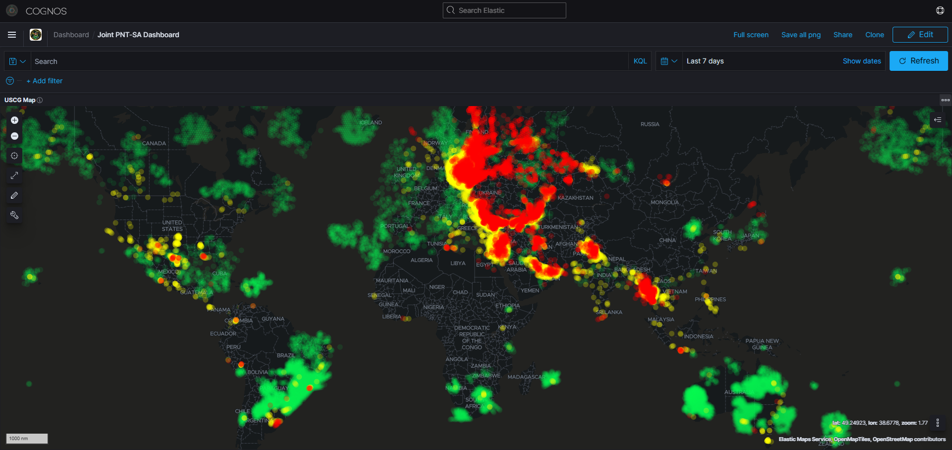
Why it’s important: GNSS interference has already caused or been a big factor in ship groundings, collisions, and fires. Loss of life in future incidents is probable.
What else to know:
- Some interesting similarities with aviation including unnecessary use of GNSS signals by critical and important systems.
- The RIN’s blog post is reproduced below. We highly recommend you download and study the report.
- Well done RIN!
![]()
Maritime Navigation Group posted Industry maritime report highlights growing need for GNSS resilience
We’re delighted to announce the publication of the RIN Maritime report revealing the impacts of GNSS Interference in the Maritime sector. Survey data was compiled from over 100 sector experts and 300 vessel Captains, supported by interviews with dozens of people involved in the operations and supply chain of vessels that regularly encounter GNSS interference.
GNSS interference refers to anything that disrupts a ship’s satellite-based positioning signals usually caused by:
- Jamming: blocking or overwhelming the satellite signals with noise so the receiver can’t get a position at all;
- or spoofing: feeding the receiver false satellite signals so it reports a wrong position that looks legitimate.
In 2025, at least two collisions and groundings were reported in mainstream media linked to GNSS interference in regions such as the Baltics, Straits of Hormuz and the Red Sea. With hundreds of vessels being affected daily, the RIN report details for the first time the scale of the problem on modern digital vessels whereby GNSS jamming and spoofing present a significant cybersecurity vulnerability and urgent risks to maritime safety.
Survey data exposes the vulnerability of critically important systems such as Global Maritime Distress and Safety Systems (GMDSS) and other SOLAS-mandated equipment that rely on satellite positioning and timing.
“The report has highlighted serious safety concerns and has underlined the fact that these issues are rooted in significant cybersecurity vulnerabilities, and are not just disruptions to navigation”, mentions Director of the RIN, Dr Ramsey Faragher.
Operating within regions of known GNSS interference carries serious safety-of-life and liability implications, as key systems are expected to fail or malfunction with high probability in these conditions. The report also highlights unnecessary dependencies between GNSS receivers and a range of onboard electronics — including RADAR, radios (VHF/MF/HF), NAVTEX, speed logs, ship clocks and satellite communications — many of which do not require GNSS data for their primary function, creating avoidable points of failure and compounding operational risk.
Maritime Captain Ivana-Maria Carionni-Burnett and chair of the RINs Maritime Navigation Group comments: “The issue of GNSS interference must be taken seriously. It cannot be overcome by traditional navigation techniques when GNSS receivers are ‘baked in’ to modern ships’ critical systems, including safety systems. These are no longer isolated incidents and pose a real risk to life: people, property and the environment. We must do more to safeguard our seas today and the shipping of tomorrow.”
Retired Commodore James Taylor OBE and fellow of the RIN advises: “Despite measures to improve resistance to jamming, spoofing and other harassment measures, the threat is real and growing. And this threat is not only to positioning and navigation; it is to every part of every transport and navigation means and to every part of national infrastructure where timing is derived from space-based timing signals.”
The Royal Institute of Navigation will continue to work with report partners (GLA, IALA, Nautical Institute and others) and regulatory bodies to provide expert guidance to mitigate these issues, and to establish industry-wide adoption of solutions to this problem.
The RIN Maritime Report Working Group will unpack key findings of the report on 29th January at National Maritime Museum with a digital download available online.