Editor’s Note: Last week we published a thought experiment about how a cargo ship could be spoofed and sailed into the hands of bad actors. This week we discuss how masters, companies and nations can help prevent such things from happening.
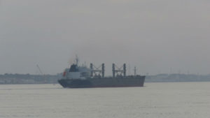
Credit Diamantino Rosa
A recent article in The Maritime Executive described how a malicious actor could, with minimal effort, influence a ship’s course and speed over the period of several days. In the example given, the ship was sailed to a sparsely populated Indonesian island 220 nautical miles from its intended waypoint, the entrance to the Malacca Strait. The vessel would also have made landfall ten hours earlier than expected adding to crew confusion and the advantage of the bad actors seeking to take control.
While the equipment required to deceive GPS/GNSS receivers and “take over” a ship’s navigation system is relatively inexpensive and easy to use, there are things that masters, companies and nations can do to prevent these kinds of maritime cyber attacks.
Masters
• For such an attack to occur, a spoofing device would most likely be aboard the vessel, probably in the possession of a member of the crew or a passenger. Masters should be aware of all electronic devices that come aboard and their potential to interfere with ship’s systems. As it may be difficult to determine the exact purpose of a particular piece of equipment, masters should consider placing questionable devices in quarantine for the duration of the voyage.
• Equipment to detect relatively strong GPS/GNSS jamming and spoofing signals is easily available and reasonably inexpensive. Masters should consider acquiring a detector and regularly using it while at sea.
• Low-power GPS/GNSS jamming and spoofing is more difficult to detect, but requires the transmitter to be in closer proximity to the ship’s GNSS antennas. Masters should ensure that physical security prevents unauthorized access to locations near GPS/GNSS antennas.
• Masters should use multiple sources of navigation information whenever possible. The old navigator’s axiom “A prudent mariner uses every means available to determine their position” applies as much today as ever. Depending upon conditions and location, visual bearings, radar ranges, celestial fixes, radio beacons, and even depth soundings can be used to confirm GPS/GNSS. If the ship is so equipped, Loran navigation signals are available in the Persian Gulf, offshore China, Russia, South Korea and some parts of India.
Companies
• Ensure vessel satellite navigation equipment has anti-jam and anti-spoof technology. This includes multi-element antennas that can detect and ignore GPS/GNSS signals not coming from the direction of known satellites, and software that rejects signals that are too strong or are distorted, as occurs when false and authentic signals interact. See: “GNSS spoofing and detection” Proceedings of the IEEE 104.6 (2016): 1258-1270 by Mark L. Psiaki and Todd E. Humphreys.
• Receivers should also be able to access multiple satellite systems in addition to GPS. Europe’s Galileo, China’s Bei Dou and Russia’s GLONASS provide global coverage. Japan and India also have regional navigation satellite systems.
• Equip vessels with two GPS/GNSS antennas and physically separate them as much as possible. This makes spoofing the receiver much more difficult, as it requires the attacker to coordinate a consistent attack on both antennas simultaneously. See the recent article: “Hostile Control of Ships via False GPS Signals” in Navigation, Journal of the Institute of Navigation, Vol 64, No 1 Spring 2017 by Jahshan Bhatti and Todd E. Humphreys.
• Equip vessels with Loran/eLoran receivers to take advantage of signals when they are available. In addition to the areas mentioned above, the United States is doing development work and has announced it will establish an eLoran network. An eLoran network is also reported to be under consideration by nations in northwestern Europe.
Nations
• National governments should aggressively combat the import, sale and use of GPS/GNSS jamming and spoofing equipment. At this year’s Munich Satellite Navigation Summit, a representative of the European Commission reported that studies had identified more than 100,000 unique electronic signatures of jamming equipment on the continent. In the United States sampling has shown more than 25 percent of commercial trucks using jamming devices.
• All nations should provide a difficult-to-disrupt terrestrial navigation signal as complement and backup for satellite systems and encourage its use. eLoran signals, for example, propagate exceptionally well over saltwater and are usable up to 1,800 nautical miles away. And useful navigation information (range and bearing) can be obtained from eLoran even if only one transmitter is in view.
The opinions expressed herein are the author’s and not necessarily those of The Maritime Executive.